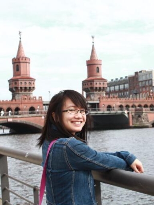
个人简介
韦春竹,博士,中山大学地理科学与规划学院副教授,硕士生导师。研究方向为全球城市群扩张、海岸带遥感、人口空间化、城市热环境及相关城市遥感分析与应用分析。
长期招收硕士生,欢迎遥感或GIS专业有志于城市化相关研究的本科生联系报考。
教育背景
2013.10 - 2017.05 奥地利萨尔茨堡大学 地理信息科学专业 理学博士
2010.09 - 2013.06 电子科技大学 地图制图学与地理信息工程专业 工学硕士
2006.09 - 2010.06 西北大学 地理信息系统专业 理学学士
工作经历
2019.03 至今 南方海洋科学与工程广东省实验室(珠海)海洋人文地理创新团队秘书
2019.03 至今 中山大学地理科学与规划学院 副教授
2017.10 - 2019.02 德国维尔茨堡大学地理学院 博士后
2013.10 - 2017.05 奥地利萨尔茨堡大学地理学院 研究助理
2011.09 - 2013.07 中科院遥感所定量遥感实验室 研究助理
讲授课程
本科生: 社会文化地理、人文地理学、遥感原理与应用、大数据在地理学中的应用,城市规划中的数学方法
科研项目
- 珠海市自然资源局项目:珠海海洋经济公共服务体系建设研究。2021,主持
- 国家自然科学基金青年科学基金项目:环南海区域港口-临港区域的时空演变及其机制:基于全球、跨国区域、国家和地方的多尺度研究。2021-2023, 主持
- 广州市基础与应用基础基金项目:基于高分辨率雷达和光谱影像的内陆水产养殖基地动态监测-以广东省海岸带为例。2020-2022,主持
- 南方海洋科学与工程广东省实验室(珠海)创新团队建设项目:南海周边国家(地区)人文地理过程及其空间响应。2019-2022,主要参与人
- 国家社会科学基金项目:No.17BJL104,西南边境地区贫困户“脱贫摘帽”后可持续生计研究,2017.7-2020.12,主要参与人
- 欧盟欧空局哥白尼项目:No.EMSN034,Coastal flood risk analysis for population and assets, Caparica, Setubal, Portugal,2017.05-2017.07,主要参与人
- 欧盟欧空局哥白尼项目:No.EMSN033,Satellite based Conflict damage assessment of two selected cities in Libya,2017.02-2017.04,主要参与人
- 广西教育厅课题:No.YB116,广西左右江革命老区县域经济的空间结构调整与产业布局优化研究,2016.01-2020.01,主要参与人
- 广西哲学社会科学规划办青年课题:No.15EJL001,常态下广西左右江流域经济空间结构调整与发展方式转变研究,2015.12-2018.12,主要参与人
- 广西教育厅课题:No.LX2014100,广西北部湾经济区县域经济发展差异的时空特征分析,2013.01-2014.12,主要参与人
- 国家国际科技合作项目:No.2010DFA21880,中匈城市生态环境空间信息遥感提取与分析模型研究,2012.01-2013.06,主要参与人
论文发表
- Lu, Yang, Chunzhu Wei, Matthew F. McCabe, and Justin Sheffield. "Multi-variable assimilation into a modified AquaCrop model for improved maize simulation without management or crop phenology information." Agricultural Water Management 266 (2022): 107576.
- Wang, Bo, Yaqin Lei, Desheng Xue, Jixiang Liu, and Chunzhu Wei. "Elaborating Spatiotemporal Associations Between the Built Environment and Urban Vibrancy: A Case of Guangzhou City, China." Chinese Geographical Science (2022): 1-13.
- Zhou, Liang, Fengning Hu, Bo Wang, Chunzhu Wei, Dongqi Sun, and Shaohua Wang. "Relationship between urban landscape structure and land surface temperature: spatial hierarchy and interaction effects." Sustainable Cities and Society (2022): 103795.
- Zhou, Liang, Bo Yuan, Fengning Hu, Chunzhu Wei, Xuewei Dang, and Dongqi Sun. "Understanding the effects of 2D/3D urban morphology on land surface temperature based on local climate zones." Building and Environment 208 (2022): 108578.
- Wei, Chunzhu*, Wei Chen, Yang Lu, Thomas Blaschke, Jian Peng, and Desheng Xue. "Synergies between Urban Heat Island and Urban Heat Wave Effects in 9 Global Mega-Regions from 2003 to 2020." Remote Sensing 14, no. 1 (2021): 70.
- Tan, Weiwei, Chunzhu Wei*, Yang Lu, and Desheng Xue. "Reconstruction of All-Weather Daytime and Nighttime MODIS Aqua-Terra Land Surface Temperature Products Using an XGBoost Approach." Remote Sensing 13, no. 22 (2021): 4723.
- Wei, Chunzhu*, Qianying Zhao, Yang Lu, and Dongjie Fu. "Assessment of Empirical Algorithms for Shallow Water Bathymetry Using Multi-Spectral Imagery of Pearl River Delta Coast, China." Remote Sensing 13, no. 16 (2021): 3123.
- Lu, Yang, and Chunzhu Wei*. "Evaluation of microwave soil moisture data for monitoring live fuel moisture content (LFMC) over the coterminous United States." Science of the Total Environment 771 (2021): 145410.
- Mast, Johannes, Chunzhu Wei, and Michael Wurm. "Mapping urban villages using fully convolutional neural networks." Remote Sensing Letters 11, no. 7 (2020): 630-639.
- Wang, Xinsheng, Ting On Chan, Kai Liu, Jun Pan, Ming Luo, Wenkai Li, and Chunzhu Wei. "A robust segmentation framework for closely packed buildings from airborne LiDAR point clouds." International Journal of Remote Sensing 41, no. 14 (2020): 5147-5165.
- Prasad, Kumar Arun, Marco Ottinger, Chunzhu Wei, and Patrick Leinenkugel. "Assessment of Coastal Aquaculture for India from Sentinel-1 SAR Time Series." Remote Sens. 11 (2019): 357.
- Wei, Chunzhu*, and Thomas Blaschke."Pixel-Wise vs. Object-Based Impervious Surface Analysis from Remote Sensing: Correlations with Land Surface Temperature and Population Density." Urban Science 2.1 (2018): 2.
- Wei, Chunzhu*, Thomas Blaschke , Pavlos Kazakopoulos , Hannes Taubenböck , and Dirk Tiede. "Is spatial resolution critical in urbanization velocity analysis? Investigations in the Pearl River Delta." Remote Sensing. 1, No.9 (2017):80.
- Wei, Chunzhu*, Mark Padgham, Pablo Cabrera-Barona, and Thomas Blaschke. "Scale-Free Relationships between Social and Landscape Factors in Urban Systems." Sustainability 1 , No.9 (2017): 84.
- Wei, Chunzhu*, Hannes Taubenböck, and Thomas Blaschke. "Measuring urban agglomeration using a city-scale dasymetric population map: A study in the Pearl River Delta, China." Habitat International 59 (2017): 32-43.
- Wei, Chunzhu*, Pablo Cabrera-Barona, and Thomas Blaschke. "Local geographic variation of public services inequality: does the neighborhood scale matter?." International Journal of Environmental Research and Public Health 13, no. 10 (2016): 981.
- Cabrera-Barona, Pablo, Chunzhu Wei, and Michael Hagenlocher. "Multiscale evaluation of an urban deprivation index: Implications for quality of life and healthcare accessibility planning." Applied Geography 70 (2016): 1-10.
- Wei, Chunzhu*, and Thomas Blaschke. "Identifying local scale climate zones of urban heat island from HJ-1B satellite data using self-organizing maps."Int. Arch. Photogramm. Remote Sens. Spatial Inf. Sci., XLI-B8, 1431-1436, doi:10.5194/isprs-archives-XLI-B8-1431-2016, 2016.
- Wei, Chunzhu*, Thomas Blaschke, and Hannes Taubenböck. "Monitoring of "urban villages" in Shenzhen, China from high-resolution GF-1 and TerraSAR-X data." In SPIE Remote Sensing, pp. 964210-964210. International Society for Optics and Photonics, 2015.
- Wei, Chunzhu*, Pablo Cabrera-Barona, and Thomas Blaschke. "Where is the poverty area? Quantifying the neighborhood effect in a deprivation index estimation: a case study in Quito, Ecuador". GI_Forum, (2015):625-634.
- Lehner, Arthur, Vaentin Kraus, Chunzhu Wei, and Steinnocher Klaus. "Growth scenarios for the city of Guangzhou, China: Transferability and confirmability." ISPRS-International Archives of the Photogrammetry, Remote Sensing and Spatial Information Sciences (2016): 61-66.
- Wei, Chunzhu*, Qinyan Meng, and Wenfeng Zheng." A research on population emergency evacuation based on revised ACO-CA". GeoInformatics Conference collection,2012.
- 韦春竹, 郑文锋, 孟庆岩, 王春梅,刘苗. "基于元胞自动机的遗传神经网络在土地利用变化模拟分析中的应用." 测绘工程 23, 1 (2014): 45-49.
- 韦韡, 韦春竹. "老少边穷地区县域经济效率的空间特征分析——以广西河池 10 个县市为例." 广西民族大学学报: 哲学社会科学版 1 (2013): 170-175.
- 韦春竹, 孟庆岩, 郑文锋, 李小江, 魏曦,王靓, "广州市地表温度反演与土地利用覆盖变化关系研究." 遥感技术与应用 28, 6 (2013): 955-963.
- 郑进军,韦春竹,许文波,洪超,"CLIGEN 模型主要降雨参数精度评价." 电子科技大学学报 42, 3 (2013): 432.
- 韦春竹,谢元礼,白娟,孙增菊,"陆上交通应急疏散系统."西北大学(自然学报(增刊)),5(2010).
- 韦春竹,谢元礼,韦韡,"基于Dial分流的陆上交通应急疏散模型的优化和实现."测绘装备与技术9 (2009).


