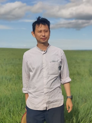
齐志新,副教授,博士生导师。 研究方向涵盖城市遥感,土地利用/土地覆盖变化监测,洪涝及地质灾害监测,雷达遥感数据处理与应用。已发表论文40余篇,其中第一作者或通讯作者论文23篇,成果发表于 Remote Sensing of Environment、ISPRS Journal of Photogrammetry and Remote Sensing 等国际知名期刊。主持国家自然科学基金面上项目、国家重点研发计划项目子课题、广东省自然科学基金项目及广州市重点研发计划等多项科研项目。
诚挚欢迎有志于攻读硕士、博士学位及从事博士后研究的同学与我联系
联系方式:qizhixin@mail.sysu.edu.cn
Zhixin Qi, Associate Professor and Ph.D. Supervisor. His research interests encompass urban remote sensing, land use and land cover change (LUCC) monitoring, flood and geological hazard monitoring, radar remote sensing data processing and applications. He has published over 40 papers, including 23 as the first or corresponding author, with results appearing in leading international journals such as Remote Sensing of Environment and ISPRS Journal of Photogrammetry and Remote Sensing. He has led multiple research projects, including the National Natural Science Foundation of China, sub-projects of the National Key R&D Program of China, the Guangdong Natural Science Foundation, and the Guangzhou Key R&D Program.
Highly motivated students interested in pursuing Master's or Ph.D. degrees, as well as postdoctoral research, are warmly welcome to get in touch
Contact: qizhixin@mail.sysu.edu.cn
学历背景
- 01/2008–10/2012,博士学位,城市规划与设计系,香港大学
- 09/2005–01/2008,硕士学习,地理科学与规划学院,中山大学
- 09/2001–07/2005,学士学位,地球科学学院,东北石油大学
工作经历
- 04/2018–至今,副教授、博士生导师,中山大学
- 07/2015–04/2018,讲师,中山大学
- 11/2012–07/2015,博士后,香港大学
代表论著
- Lin, S., Qi, Z.*, Li, X., Zhang, H., Lv, Q., and Huang D. (2024). A phenological-knowledge-independent method for automatic paddy rice mapping with time series of polarimetric SAR images. ISPRS Journal of Photogrammetry and Remote Sensing, 218, 628-644.
- Hu, Y., Qi, Z.*, Zhou, Z., Qin, Y. (2024). Detection of Benggang in remote sensing imagery through integration of segmentation anything model with object-based classification. Remote Sensing, 16, 428.
- Huang, D., Qi, Z.*, Lin, S., Gu, Y., Song, W., Lv, Q. (2024). Investigating the structural health of high-rise buildings and its influencing factors using Sentinel-1 synthetic aperture radar imagery: a case study of the Guangzhou–Foshan metropolitan area. Buldiings, 14, 4074.
- Qi, Z., Yeh, A.G.O., Li, X., and Liu, X. (2022). A land clearing index for high-frequency unsupervised monitoring of land development using multi-source optical remote sensing images. ISPRS Journal of Photogrammetry and Remote Sensing, 187: 393-421.
- Xian, S., Qi, Z.*, and Yip, N. (2022). Beyond home neighborhood: Mobility, activity and temporal variation of socio-spatial segregation. Journal of Transport Geography, 99, 103304.
- Li, L., Wang, L., and Qi, Z.* (2021). The spatiotemporal variation of farmland use transition and its critical influential factors in coordinated urban-rural regions: A case of Chongqing in western China. Sustainable Cities and Society, 70, 102921.
- Zhang, H., Qi, Z.*, Li, X., Chen, Y., Wang, X., He, Y. (2021) An urban flooding index for unsupervised inundated urban area detection using Sentinel-1 polarimetric SAR images. Remote Sensing, 13, 4511.
- Liu, D., Qi, Z.*, Zhang, H., Li, X., Yeh, A.G.O., and Wang, J. (2021). Investigation of the capability of multitemporal RADARSAT-2 fully polarimetric SAR images for land cover classification:a case of Panyu, Guangdong province. European Journal of Remote Sensing, 54, 338-350.
- Qi, Z., Yeh, A.G.O., and Li, X. (2019). Scattering-mechanism-based investigation of optimal combinations of polarimetric SAR frequency bands for land cover classification, Photogrammetric Engineering & Remote Sensing, 85(11): 799-813. (John I. Davidson President's Award for Practical Papers)
- Shi, Y., Qi, Z.*, Liu, X., Niu, N., and Zhang, H. (2019). Urban land use and land cover classification using multisource remote sensing images and social media data, Remote Sensing, 11, 2719.
- Xu, S., Qi, Z.*, Yeh, A.G.O., and Li, X. (2019). Investigation of the effect of the incidence angle on land cover classification using fully polarimetric SAR images. International Journal of Remote Sensing, 40, 1-18.
- Qi, Z., Yeh, A.G.O., and Li, X. (2017). A crop phenology knowledge-based approach for monthly monitoring of construction land expansion using polarimetric synthetic aperture radar imagery. ISPRS Journal of Photogrammetry and Remote Sensing, 133, 1-17.
- Qi, Z., Yeh, A.G.O., Li, X., Shi, X, and Zhang, X. (2015). Monthly short-term detection of land development using RADARSAT-2 polarimetric SAR imagery. Remote Sensing of Environment, 164, 179-196.
- Qi, Z., Yeh, A.G.O., Li, X., and Zhang, X. (2015). A three-component method for timely detection of land cover changes using polarimetric SAR images. ISPRS Journal of Photogrammetry and Remote Sensing, 107, 3-21.
- Qi, Z. and Yeh, A.G.O. (2015). Land use and land cover mapping and change detection and monitoring using radar remote sensing. In Prasad S. Thenkabail (Eds.), Remote Sensing Handbook. Taylor and Francis.
- Qi, Z., Yeh, A.G.-O., Li, X., and Lin, Z. (2012). A novel algorithm for land use and land cover classification using RADARSAT-2 polarimetric SAR data. Remote Sensing of Environment, 118, 21–39.
- Qi, Z., Yeh, A.G.O., Li, X., and Lin, Z. (2012). Integration of polarimetric decomposition, object-oriented image analysis, and decision tree algorithms for land-use and land-cover classification using RADARSAT-2 polarimetric SAR data. Photogrammetric Engineering & Remote Sensing, 78, 1319–1332.
完整文章列表请见谷歌学术
For a complete list of publications, please visit my Google Scholar profile.
授权专利
- 齐志新;一种生产建设用地的高频次全自动遥感监测方法,2023年03月24日,ZL 2021 1 1198587. 8.
- 齐志新;一种基于多源光学遥感图像的违法建设用地开发自动检测方法,2021年09月07日,ZL 2020 1 1252635. 2.
- 齐志新;张慧;一种基于极化雷达遥感影像的城市内涝区检测方法,2021年04月16日,ZL 2020 1 1257248. 8.
- 齐志新;沈雪娇;张慧;基于Landsat时间序列遥感影像的城市更新区域监测方法,2020年09月11日,ZL 2019 1 1422273. 4.
授权软著
- 宋文宣,齐志新;建设用地开发初期地表清理遥感智能检测软件V1.0, 2025年6月18,2025SR1036561.
- 齐志新;生产建设项目水土保持监管扰动图斑检测软件V1.0,2023年01月09日,2023SR0041729.
- 林素雅;齐志新;基于哨兵1号数据的水稻提取软件V1.0,2022年09月09日,2022SR1350127.
- 齐志新;基于极化雷达遥感的洪涝灾害监测系统V1.0,2022年07月22日,2022SR0961416.
- 齐志新;水土保持监管扰动图斑自动提取系统V1.0,2022年03月07日,2022SR0316963.
- 马皓轩;齐志新;多源遥感数据的城市地物目标识别软件V1.0,2021年10月15日,2021SR1517691.
- 邵昱松;齐志新;融合多源遥感数据的土地利用分类软件V1.0,2021年10月11日,2021SR1480708.
- 齐志新;建设用地开发遥感监测系统V1.0,2021年06月15日,2021SR0892635.
- 齐志新;Sentinel-2遥感影像批量下载软件V1.0,2021年06月15日,2021SR0892636.
- 张慧;齐志新;基于哨兵1号极化雷达遥感影像的城市洪涝灾害监测软件V1.0,2020年12月02日,2020SR1711009.
- 齐志新;融合多源遥感数据的违法土地开发短周期监测软件V1.0,2020年08月11日,2020SR0907745.
- 齐志新;沈雪娇;张慧;丁昱;基于Google Earth Engine云平台的城市更新遥感监测软件V1.0,2020年06月22日,2020SR0661475.
主持项目
- 国家自然科学基金面上项目,“多源遥感时空谱特征联合的新增建设用地开发高频快速监测研究”(42271334),2023年1月–2026年12月
- 广州市重点研发计划项目,“城市建设用地开发智能检测技术研究及示范应用”(202206010018),2022年4月1日–2025年3月31日
- 国家重点研发计划项目“粤港澳大湾区城市群综合决策和协同服务研究与示范”(2019YFB2103100)子课题,“城市群地理要素智能识别技术”,2020年1月–2022年12月
- 国家重点研发计划项目““人-地”耦合的高精度全球土地利用演变模拟及应用”(2017YFA0604400)子课题,“土地利用变化对典型生态系统演变的影响”,2017年7月–2022年6月
- 国家自然科学基金青年科学基金项目,“基于极化雷达和光学遥感的城市扩张短周期自动监测方法研究”(41601445),2017–2019
- 广东省自然科学基金项目,“多云多雨地区每月建设用地开发的极化雷达遥感自动监测”(2016A030313230),2016–2019
- 中山大学青年教师培育项目,“多时相星载极化雷达的农作物分类及产量估算”(16lgpy05),2016–2018
- Small Project Funding of The University of Hong Kong, “Land Use and Land Cover Classification Using Multi-Frequency and Multi-Polarization SAR Images”, 2013–2014
出版教材
- 《GeoScene Pro 地理信息系统实验教程》,齐志新,陈逸敏, 刘小平,中山大学出版社,2025.
- 《空间数据分析方法实战教程》, 陈逸敏, 齐志新, 刘小平,中山大学出版社,2023.
讲授课程
- 地理信息系统导论(含实验)
- 空间分析原理与方法(含实验)
- 高级空间分析技术与方法
获奖情况
- 2024年10月,金粤自然资源科学技术奖一等奖,金粤自然资源科学技术奖励办公室
- 2022年07月,全国高校青年教师GIS教学研修班微课竞赛一等奖,中国地理信息产业协会教育工作委员会
- 2020年03月,约翰·戴维森主席奖(John I. Davidson President's Award for Practical Papers),美国摄影测量与遥感协会(ASPRS)
- 2013年12月,Li Ka Shing Prizes for the Best PhD Theses, The University of Hong Kong


