
Short Description
Dr.George Grekousis is an Associate Professor at the School of Geography and Planning, Department of Urban and Regional Planning, Guangzhou, China. He is recognized as a leading researcher, consistently ranking among the top 2% of scientists globallyon Stanford University's list for 2023, 2024, and 2025. His extensive academic background includes studies in both Greece and the United States, followed by over fifteen years of dedicated teaching. George’s core research interests are Data Science, Spatal Data Analysis, Machine Learning, Health Geodemographics, and Artificial Intelligence.
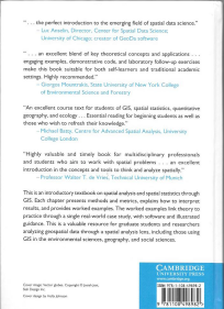
His interdisciplinary research combines machine learning and spatial modeling with social data to study significant challenges related to human health and well-being from a geographical perspective.George has been awarded several grants from well-known international bodies, and he has published more than 40 scientific papers in SSCI journals, including Computers Environment and Urban Systems, Landscape and Urban Planning, Health and Place, and Applied Geography. Three of his papers have been selected as ESI Highly Cited Papers (Claritive Web of Science).He has authored the book “Spatial analysis methods and practice: Describe – Explore – Explain through GIS”, Cambridge University Press, NY (532 pages), and has presented his research at numerous international scientific conferences.
Join us
Currently my lab is seeking for Postdoctoral and Master students interested in high-impact large-scale interdisciplinary studies, using Machine Learning techniques and Spatial Analysis
Relevant topics include, but are not limited to:
a) Spatial Machine Learning / Machine Learning,
b) Health Geography / Human Geography,
c) Computational Social Science,
d) Air-quality and Sustainability,
If you have a research idea and you have basic Python knowledge (or you are willing to acquire), feel free to contact me directly at: geogreko@outlook.com or graikousis@mail.sysu.edu.cn
To avoid emails are accidently sent to SPAM, do not include any attachments in the first contact. Just use the main body of the email to present your shelf briefly.
Academic Background
- Postdoctoral Research Associate. USA State University of New York. Department of Environmental Research Engineering.
- Ph.D. in Computational (AI) Spatial Analysis. Department of Geoinformatics Engineering. National Technical University of Athens Greece.
- Master of Science in Geoinformatics. Department of Geoinformatics Engineering. National Technical University of Athens Greece.
- Diploma in Engineering. Department of Geoinformatics Engineering. National Technical University of Athens Greece.
Working Experience
2017–Now
Associate Professor, School of Geography and Planning, Department of Urban and Regional Planning, Guangzhou, China
2013-2017
Assistant Professor, Department of Civil Engineering, University of Thessaly, Greece
International Memberships
American Association of Geographers (Member ID:90064501)
Regional Science Association (International
European Working Group for Location Analysis
Main Courses
Data Science and Machine Learning in Urban Analytics
Urban Spatial Analysis and Applications
Urban Geography
Human Geography
Representative Publications
Full list at: https://scholar.google.gr/citations?user=mXBowe8AAAAJ&hl=en
Grekousis G.* (2025).Geographical-XGBoost: A new ensemble model for spatial regression based on gradient-boosted trees. Journal of Geographical Systems. 27(2). https://doi.org/10.1007/s10109-025-00465-4. JGS Editors’ Choice Best Paper
Lin Y., & Grekousis G.* (2025). Can geodemographic clustering be fair? Incorporating social fairness in crisp and fuzzy approaches through a unified framework. International Journal of Geographical Information Science, 1-26. https://doi.org/10.1080/13658816.2024.2444525
Wang R, Sun M., Yi S. Grekousis G*, Dong G. (2025)Exploring the associations between street-view green space quantity and quality, and influenza in Guangzhou, China through machine learning and spatial regression: A socio-economic equity perspective. Environment and Planning B: Urban Analytics and City https://doi.org/10.1177/23998083241312272
Grekousis G.*, Sunarta N., Stratoulias D. (2024). Tracing vulnerable communities to ambient air pollution exposure: A geodemographic and remote sensing approach. Environmental Research. (Impact Factor = 8.4, Web of Science SSCI, Q1)https://doi.org/10.1016/j.envres.2024.119491
Grekousis G.*, Feng Z., Marakakis I., Lu, Y, Wang R. 2022. Ranking the importance of demographic, socioeconomic, and underlying health factors on US COVID-19 deaths: A geographical random forest approach. Health and Place, 74, 102744. (ESI Highly Cited Paper)
Grekousis G.* 2021. Local fuzzy geographically weighted clustering: a new method for geodemographic segmentation. International Journal of Geographical Information Science, 35(1), 152-174.
Grekousis G., Wang R., Liu, Y*. 2021. Mapping the geodemographics of racial, economic, health, and COVID-19 deaths inequalities in the conterminous US. Applied Geography, 135, 102558
Grekousis G.*, & Liu, Y. 2021. Digital contact tracing, community uptake, and proximity awareness technology to fight COVID-19: a systematic review. Sustainable cities and society, 71, 102995.
Books (and chapters in books)
Grekousis G. 2020. Spatial analysis methods and practice: Describe – Explore – Explain through GIS. Cambridge University Press, NY (532 pages) DOI:10.1017/9781108614528. www.cambridge.org/9781108498982
Grekousis G., Lagos A., 2011. Principles of Surveying and Geoinformation. Synchroni Ekdotiki, Athens. (in Greek) http://www.synekdot.gr/product/978-960-6674-62-4/
Grekousis G. 2005. Spatio-temporal demand analysis in location allocation modesl utilizing Artificial Intelligence. PhD Dissertation. National Technical University of Athens, Greece.
Grekousis G., Koutsopoulos K., 2005. Artificial Neural networks. In “Spatial Analysis, theory, methods and techniques.’ Ed Koutsopolous K. Vol II. Dihnekes. Athens (in Greek).
International conferences
Grekousis G. Artificial Intelligence and Machine Learning in Spatial Analysis. 4th Congress of Geographical Information Systems and Spatial Analysis in Agriculture and Environment. 24-126 May 2022. Athens, Greece. Invited Keynote Speaker
Hatzichristos T., Tsetsos V., Ientsek S., Grekousis G.* GI-POLIS: A Location-Based Push Notification System for Public Briefing and Awareness. 15th Conference on Location Based Services. 11-13 November 2019. Vienna, Austria.
Grekousis G., Spatial analysis in geomarketing systems. 2019 International conference on management science and industrial engineering. 24-26 May 2019, Phuket, Thailand. Best paper award.
Grekousis G., Customer segmentation using GIS and fuzzy logic. 12th Annual International on Global Studies: Business, Economic, Political, Social and Cultural aspects. 20-23 December 2018, Athens, Greece
Grekousis G., Manetos P., Arvanitidis P. Does Airbnb affect commercial land use patterns? First evidence from residential areas in the city of Hong Kong. Geomapplica International Conference, Greece, Syros 25-29 June 2018.
Grekousis G. The implications of economic crisis to unemployment. A regional spatio-temporal analysis for the European Union. American Association of Geographers, annual meeting, USA, New Orleans 10-14 April 2018.
Grekousis G., Mountrakis G., Kavouras M. 2015. Assessing land cover dynamics in Europe using MODIS data. American Association of Geographers, annual meeting, USA, Chicago 21-25 April 2015.
Grekousis G., Kavouras M., Mountrakis G. 2014. Assessing land cover dynamics in Europe using MODIS data. 8th Conference of HellasGIS. Greece, Athens 11-12 December 2014
Grekousis G., Mountrakis G. 2013. Socio-economic characteristics of high/low developed land consumption areas in the conterminous U.S. 2013 Spring Land Use Land Cover NASA science team meeting, Rockville, Maryland USA, 2-4 April 2013.
Alevizaki. X., Grekousis G. 2010. Spatial analysis of crime in the city of Volos. 6th Hellas GI conference. 2-3 December 2010.
Graikousis G. 2010. A Geographical Information System with GPS for Managing Emergency Areas. MRSS 6th International Remote Sensing and GIS Conference, 28th-29th April 2010, Kuala Lumpur, Malaysia.
Grekousis G., Chatzichristos T. 2008. INSIDER. A geodemographic tool for Athens. 5th Conference of HellasGIS. Athens 4-5 December 2008.
Grekousis G., Photis Y. 2008. A spatio genetic algorithm for detecting moving objects in spatio-temporal point patterns. 55th Annual North American Meetings of the Regional Science Association International. New York-USA. Nov 19-22,2008.
Grekousis G., Chatzichristos T. 2007. Intelligent Geodemographic System for Athens- Greece(poster presentation). ESRI International User Conference, June 18-22, 2007 San Diego California–USA.
Grekousis G. 2005.A spatio temporal analysis in locational planning problems. 1st conference of new researchers. Volos-Greece 12-14 May,2005.
Grekousis G., Fotis Y., Koutsopoulos K. 2004. Solving stochastic location problems by artificial intelligence: Definition of an algorithm for spatio temporal analysis and forecast demand point patterns. Meeting of new researchers in geographic information science. Athens. 16 Jan 2004.
Grekousis G., Photis Y. 2004. A genetic algorithm for spatio-temporal point pattern analysis (Poster Presentation). Ph.d. Research Conference ITC. Enchede, The Netherlands 27 October 2004.
Grekousis G., Photis Y. 2003. Solving stochastic locational planning problems: Definition of a computational algorithm in a spatiotemporal methodological framework. 50th Annual North American Meetings of the Regional Science Association International. Philadelphia-USA. Nov 20-22,2003.
Grekousis G., Manetos P.2003. Modelling urban evolution by identifying spatio-temporal patterns and applying methods of artificial intelligence. Case Study: Athens, Greece. Third Euroconference: The European City in Transition. The City and the Region. Weimar-Germany 14-15 Nov 2003.
Grekousis G., Photis Y. 2001. Assessing Demand in Stochastic Locational Planning Problems: A neural networks approach. XIII Euro Working Group on Locational Analysis- EWGLA Meeting, Volos, Greece, December 2001.
Grekousis G., Manetos P., Photis Y. 2001. Spatial analysis and evolution of metropolitan areas by the utilization of artificial intelligence and fuzzy logic. 11th Meeting of Greek Users of GIS November 2001.
Photis Y., Grekousis G. 2000. Location analysis of emergency service systems: A neural networks approach. XII Euro Working Group on Locational Analysis- EWGLA Meeting, Barcelona, Spain, December 2000.
Research Projects
2019-2022 “The spatiotemporal effect of microscopic geographical context on migrant’s subjective wellbeing in China”. National Natural Science Foundation of China - NSFC Grant 41871140, co-I, 575.000 Chinese Yuan.
2019-2021 “Spatial-temporal behaviour and the dissimilarity of ethnic groups of international residents in the Chinese Global Cities”. National Natural Science Foundation of China - NSFC Grant 41801157, co-I, 265.000 Chinese Yuan.
2017-2019 Startup research grant. 3700-18821113. Sun Yat-sen University.
2009-2010 “Spatial Impacts of Multimodal Corridor Development: Italy-Greece-Turkey.” University of Thessaly.
2008-2009 Research Program 65/1599 “Karatheodoris, NTUA 2007: Experience of space in real time and virtual place.”
2006-2008 “Building an intelligent geodemographic system” GeoInformation SA. Operational Program "Competitiveness and Entrepreneurship" (OPCE Ι) funded from the European Regional Development Fund and Greek National funds.
2005-2008 “I-STONE: Re-engineering of natural stone production chain through knowledge based processes, eco – innovation and new organizational paradigms.” National Technical University of Athens
2004-2006 “E-Class, Spatial Analysis and GIS”. National Technical University of Athens
Fellowships and Awards
12. 2023 Included in “World’s Top 2% Scientists list” published by Stanford University and Elsevier. Database file cited and published at: Ioannidis, John P.A. (2023), “October 2023 data-update for "Updated science-wide author databases of standardized citation indicators"”, Elsevier Data Repository, V6, doi: 10.17632/btchxktzyw.6 https://elsevier.digitalcommonsdata.com/datasets/btchxktzyw/6
11. 5/2009 Best conference paper award. Grekousis G. Spatial analysis in Geomarketing Systems.
10. 2019 2019 International conference on management science and industrial engineering. 24-26 May 2019, Phuket, Thailand.
9. Siemens - State Scholarships Foundation (IKY). Program: Fellowship of Excellence for Post Doctoral Studies.
8. NASA – State University of New York. SUNY Research Foundation. Program for New Investigators.
7. Main researcher Grant (NNX08AR11G).
6. 2007 Travel expenses from ESRI Hellas for poster presentation ESRI International User Conference, San Diego, USA.
5. European Regional Development Fund and Greek National funds. Program: Competitiveness and Entrepreneurship Grant (OPCE Ι). Grant HERONP-26 25162/ERE/2519/.
4. Fellowship for PhD studies. Heraklitus Grant: Research grants with priority to basic research, co-funded from European Social Fund (75%) and Greek National Fund (25%). Period of funding: 9/2003-9/2005.
3. Scholarship for master studies. Master of science in Geoinformation. Sate Scholarships Foundation (IKY).
2. Scholarship from Bahaus University, Germany for presenting a paper in the “Third Euroconference : The European City in Transition. The City and the Region.” Weimar-Germany 14-15 Nov 2003.
1. November 2001. Best poster in the “11th Meeting of Greek ESRI Users of G.I.S” Athens, Greece